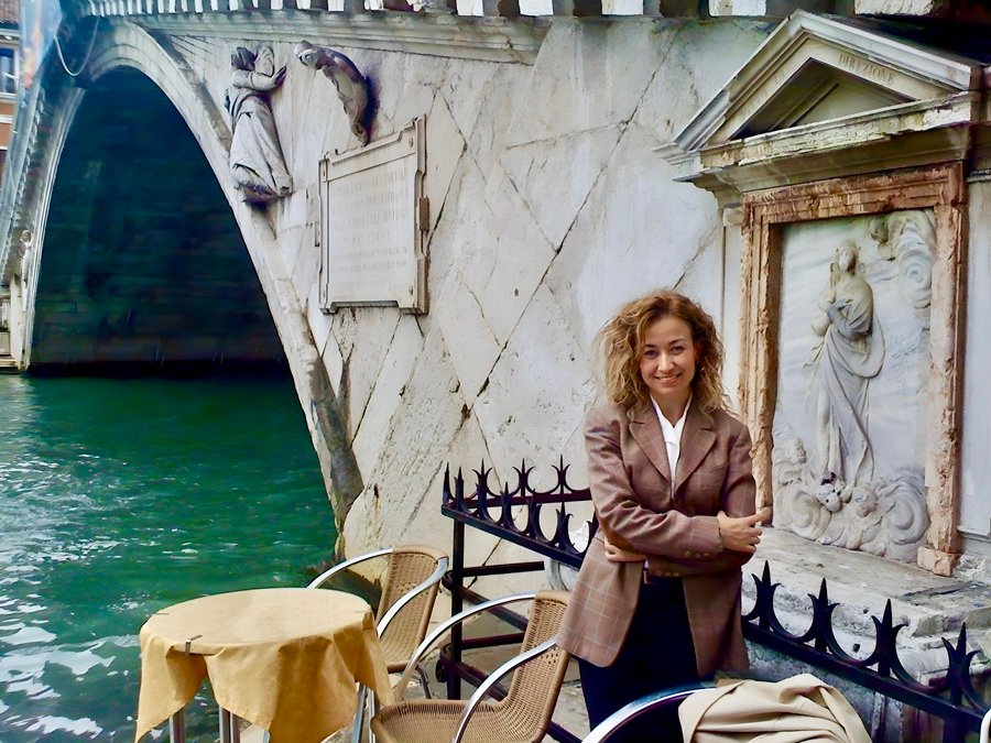
Gulsah Celiker -Director/Producer/Writer
World maritime history is largely read through a Western-centered narrative. While Christopher Columbus' name comes to the fore when it comes to the Age of Discoveries, Piri Reis, who transformed his maritime knowledge into maps in the same period, is often left out of this narrative.
The 1513 world map represents not only early geographical knowledge, but also a perspective centered on navigation, routes and maritime practice. This dossier invites us to rethink Piri Reis not as a historical figure but in the universal memory of maritime culture.
The following text was written by the director and producer, documentary filmmaker Gulsah Celiker’in Piri Reis is a special editorial work that aims to look at maritime history from a global perspective, following his research on maritime history.
“Piri Reis should be considered as a sailor who transformed maritime practice into knowledge rather than a figure who conveyed the geographical knowledge of his time.ir.”
Piri Reis Turning the Sea into Knowledge
In the words of Prof. Salih Özbaran, one of my mentors, Piri Reis is a marine scholar. In addition to being a sailor, Piri Reis also stands out as a cartographer who made world maps. His place in the world is right here. His two great world maps, the maps of 1513 and 1528, and the best maritime book of all periods, as defined by my American advisor Prof. Svat Soucek: Kitab-ı Bahriye, the best maritime book of all periods, has proven this all over the world with its Mediterranean atlas book.
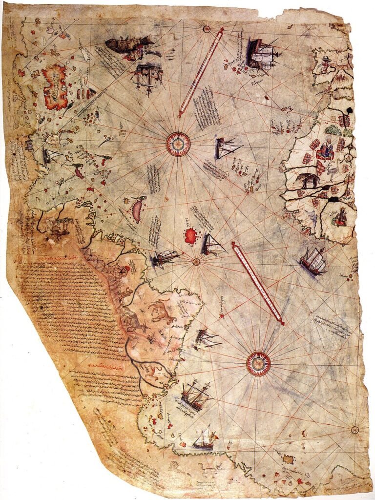
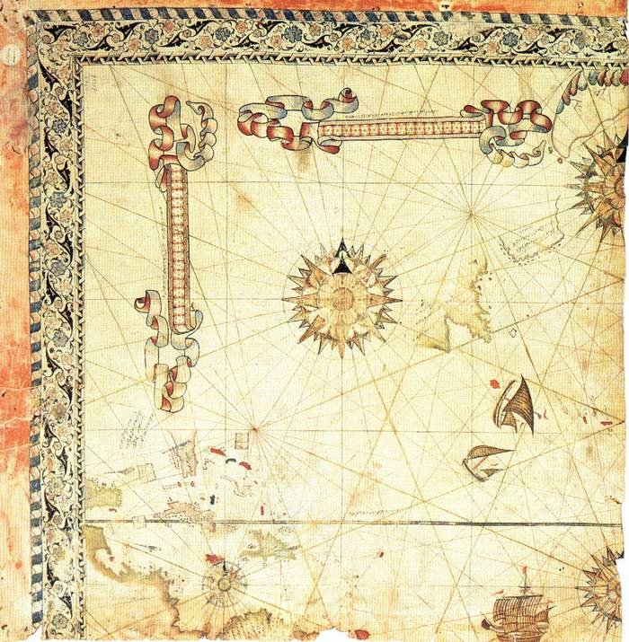
The 1513 World Map has gone down in history as the first map in which his map knowledge and navigation technique reached its peak. The most original feature of this map is undoubtedly the use of Christopher Columbus’ map of the Antillean coast. In addition, the other maps he used in the drawing of the world map; 8 Portuguese maps, 2 Indo-Chinese maps and 9 Jafariye, i.e. Arabian maps, were personally noted in the corner. This unique world map is still preserved in the Topkapı Palace Library. However, we only have the part corresponding to 4/1 or 3/1 and the part of the American continent. Because, in the same way, 4/1 part of the 1528 map has survived to the present day.
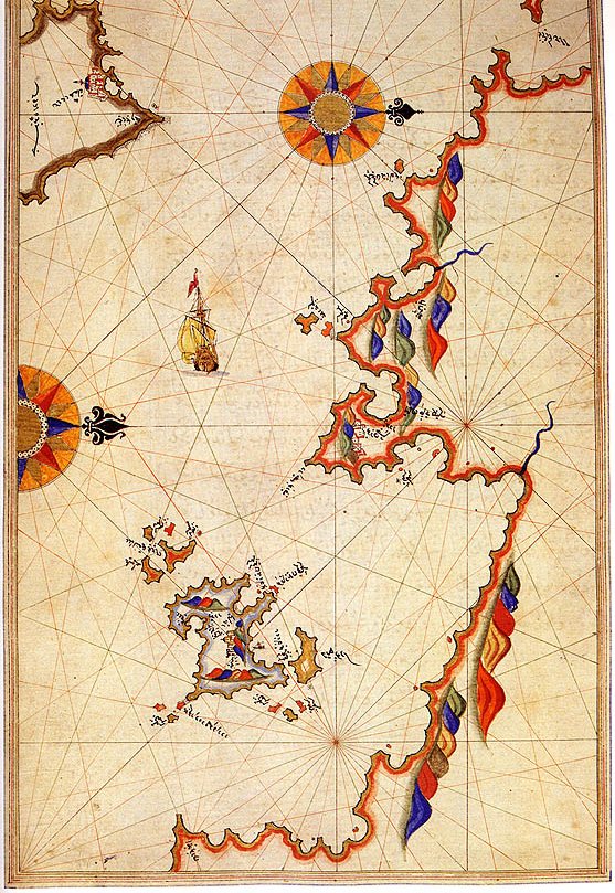
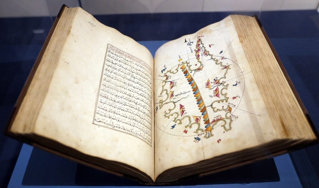
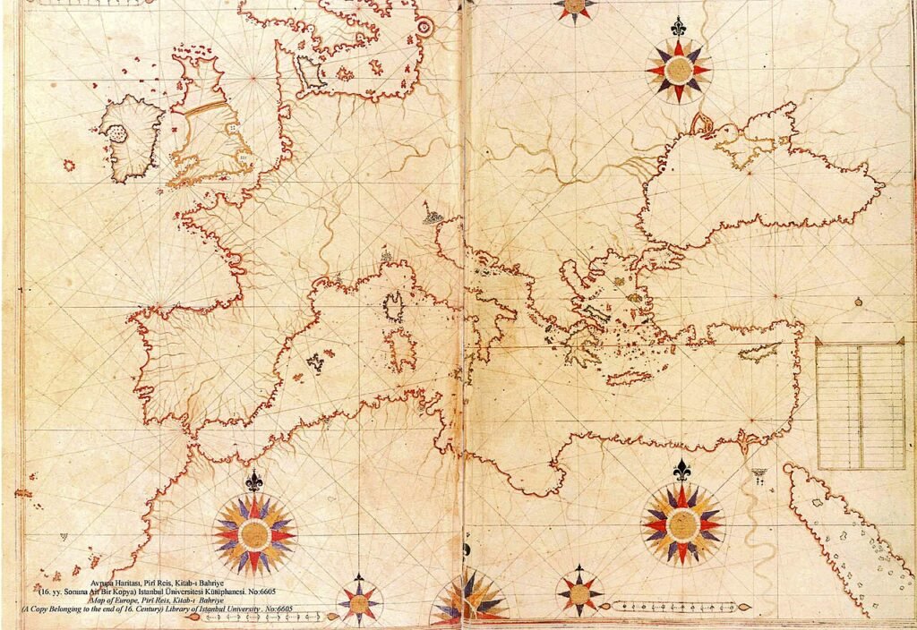
Kitab-ı Bahriye (1521) is an extraordinary Mediterranean portolan, that is, a Mediterranean atlas.
The Atlas, with its 232 Mediterranean maps, is a work at the peak of cartography of that period. Even today, it has preserved its place in the history of marine science as the most comprehensive maritime and navigation, in other words, atlas book made in the 15th-16th century. You can find one or even two copies of Kitab-ı Bahriye in the most important libraries and naval archives all over the world. It is generally available in copies of the 15-16th and 17-18th centuries in Italy, the University of Bologna, the British Library in England, the Louvre Museum in France, the Baltimore Maritime Museum in the United States and many other countries and libraries...
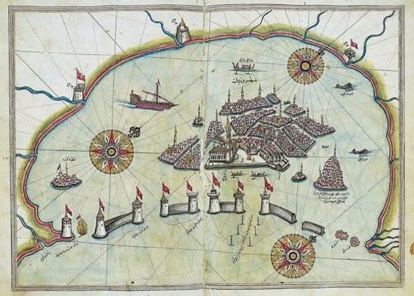
This atlas book, in which Piri Reis's navigation, route and all maritime knowledge, individual regional maps and geographical, demographic and human characteristics of the region are presented with scientific data in a prose narrative, is perhaps his most important work and the only reason why he is remembered as a marine scholar!
Piri Reis in the Shadow of the West-Centered Discovery Narrative
It is known that Christopher Columbus actually sailed to the Indies to go to the Indies and carry the wealth there to Europe, but in fact he asked for support from many kings and queens in the world, including Sultan Bayezit II, for his voyages to Antilles and America. In 1492, with the support of King Ferdinand and Queen Izabel in Spain, while waiting for the Turkish galleys coming with the order of Bayezit II to leave the port of Kadiz and pick up the Spanish Jews waiting there, he changed his route and left the port of Palos, allowing him to reach the coasts of Antilles.
After his death, the American continent was discovered thanks to the Italian Amerigo Vespucci, who identified a new continent.
Christopher Columbus' conquest of America, his voyages and his personal diary are told all over the world at primary school age. Of course, the oldest maps of the world show the map of America: Spanish, Juan De La Cosa Map 1500 (the first map of America) Portuguese Alberto Cantino Map 1502, Nikolay De Caveri Map 1504-1505, German Martin Waldseemüller Map 1507 (the first map to use the name America)
Christopher Columbus, who set out from the Spanish port of Palos to sail around the world, was aware of the existence of these and similar maps at the time. Based on these, he planned routes and travel plans...
In this framework; Piri Reis World Map 1513 is the most original among these maps, and when evaluated within the framework of the notes written on the margin, it contains Christopher Columbus' original world map. In his Kitab-ı Bahriye, Piri Reis mentions how this map was captured during a naval battle with the Spanish.
The 1528 World Map is a more advanced map in which he corrected an error in the 1513 Map.
Piri Reis's Kitab-ı Bahriyesi is an excellent atlas book with 232 maps at a time when the Mediterranean was almost a single world.
In the world, while Marco Polo, Megellan, Christopher Columbus, Amarigo Vespucci and other explorers and cartographers are mentioned, Piri Reis is not mentioned enough. In books on this subject, there are very few lines in which Piri Reis‘ two great world maps and Kitab-ı Bahriye, the Mediterranean atlas, are mentioned...
On the Trail of a Documentary
I started the Piri Reis World Cartographer Documentary with a symposium declaration. I learned about a symposium organized for the 500th anniversary of the death of Piri Reis through Prof. Celal Şengör and I was invited, but as his assistant! Of course, this was a small misunderstanding written on my card.
I first visited the professors I met at that symposium one by one in the United States (Prof. Savat Soucek, Prof. Gergory McIntosh) and received their ideas and support. The first outline, the chronological list, thus emerged. Then the research and work in Turkey and Italy continued. Prof. Halil İnalcık, Prof. İdris Bostan, Prof. Celal Şengör, Prof. Maria Pia Pedani, Prof. Simonetta Conti, Prof. Dejanirah Couto, Prof. Salih Özbaran, Prof. Alessander De Groot. .
In 2008, immediately after receiving the documentary support fund from the Ministry of Culture and Tourism, we started archival research and pre-production work inside and outside the country. Within this framework, we completed a first preview film at the end of 2009 and submitted it to the Ministry of Culture and Tourism. Later, I had the opportunity to enter the Vatican Archives in Rome, Italy with special permission, and then I had the opportunity to work in the state archives of Genoa and Venice, and we completed interview shootings in Rome, Florence and Venice, and our research developed and enriched with important documents. I even made a presentation about Piri Reis and the research and shooting process of the international documentary at the Mediterranean Maps and Piri Reis Symposium in 2013 in the port of Gaeta in Naples.
However, we have not yet completed shooting the global documentary in Spain, Portugal and drama.
From Documentary to Book: A Lasting Legacy
I started this work at an international symposium on Piri Reis held in Istanbul, where I met Prof. Svat Soucek, an American professor of the History of Eurasian Sciences at New York University, of Hungarian descent, who, as a former subject, knew Ottoman history very well, offered to prepare the first chronological list for me, so he sent me the first chronological draft of the documentary from America.
The synopsis, treatment and dramatic scripts we prepared afterwards were all built on this solid foundation and continued throughout the documentary, adding new information and even discoveries. Prof. Soucek and his book ‘Piri Reis and Turkish Mapmaking After Columbus‘ were also very instructive.
A book has emerged from ten years of extensive and comprehensive work:
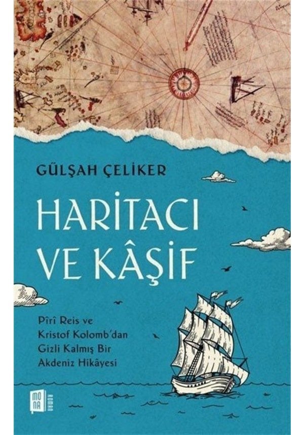
‘A Hidden Mediterranean Story from ’Cartographer and Explorer' Piri Reis and Christopher Columbus!
The global documentary is still ongoing and we continue our work with the same enthusiasm as on the first day towards research and filming in other Mediterranean countries.